Drone Based Land Mapping
Drone-Based Land Mapping & Aerial Survey Services
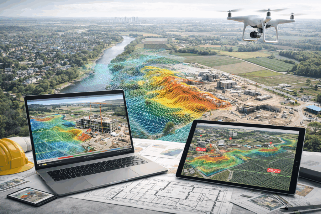
We capture and process high-resolution aerial data using UAV platforms to produce geo-referenced maps, terrain models, and 3D data that integrate with BIM, CAD, and site planning workflows.
Drone-based land mapping delivers accurate aerial survey data — including orthophotos, digital surface models, and topographic datasets — that support land development, design coordination, and construction planning. These deliverables improve site understanding, accelerate decision-making, and reduce risk during project execution.
What We Deliver
Orthophoto Maps & Aerial Imagery: Georeferenced, scale-correct aerial maps for planning and documentation.
Terrain & Surface Models: Digital elevation and surface models for grading, drainage, and site design.
3D Point Clouds & Meshes: High-resolution 3D site data for integration with BIM and CAD workflows.
Contours & Volume Analysis: Cut/fill calculations and volumetric reporting for earthwork and material planning.
Geo-referenced Deliverables: Datasets aligned to real-world coordinates for seamless use with design and survey systems.
Progress Capture & Monitoring Support: Repeatable aerial surveys to track site changes over time.
Who This Is For
Our drone mapping services support:
Civil Engineers & Survey Teams — accurate terrain and boundary datasets.
Design & Planning Professionals — geospatial context for site layout and zoning studies.
Contractors & Project Managers — aerial progress documentation and site analytics.
Owners & Developers — verified site intelligence for early-stage decisions and risk mitigation.
Why Drone Mapping Matters
Traditional ground methods for site mapping and terrain capture are time-consuming and can miss critical features on large or complex sites. Drone-based mapping collects systematic aerial data rapidly, producing measurable outputs that improve site comprehension, support BIM and GIS integration, and ensure all stakeholders work from the same trusted dataset.